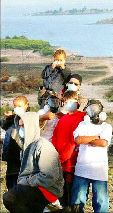
Community window on environmental exposures
by Dr. Ahimsa Porter Sumchai, Health and Environmental Science Editor
Traveling east on Palou Avenue at the intersection with Third Street, we approach the historic Crisp Road entry to the Hunters Point Naval Shipyard – a Federal Superfund system and campus of the United States Naval Radiological Defense Laboratories (NRDL) – located half a mile from the major transit center in Bayview Hunters Point.
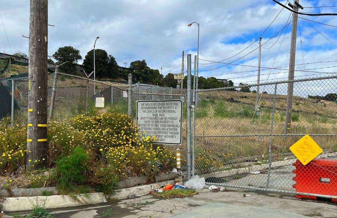
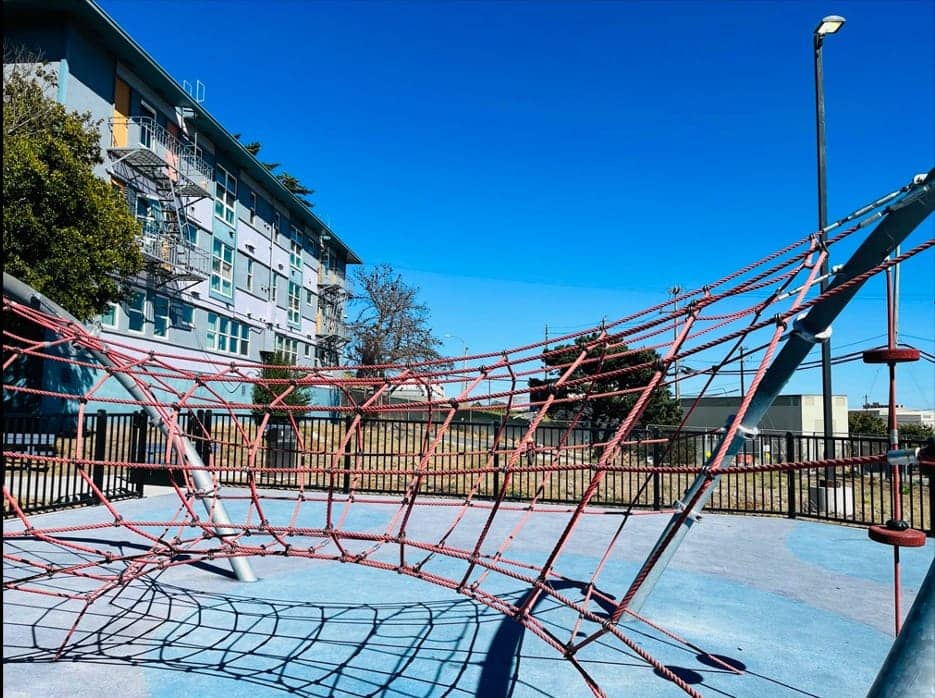

According to the Metropolitan Transportation Agency, all streets east of Third between Evans to the north and Carroll to the south lead to the western fence line or shoreline of the federal Superfund sites at the Hunters Point Naval Shipyard (HPNS) and Yosemite Slough. Palou Avenue intersects at its 1000 block origin with the Crisp Road entry to the NRDL radiation labs and radiation contaminated industrial landfill.
The dirty development of the Hunters Point Naval Shipyard: No place for a child to live, play or pray!
Entering the main gate to the shipyards’ southern shoreline we come upon the NRDL Building 800 laboratory complex. Building 830 houses approximately 15 full time state workers. It lies within 200 feet of the Parcel E-2 industrial landfill – a radioactive dump and Federal Superfund site.
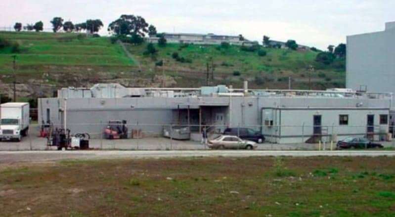
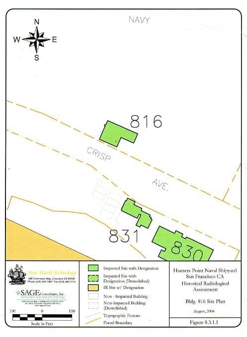
Building 830 was released to UCSF as a research animal kennel in 1970 following closure of the NRDL. It has not been cleared for human reuse by the California Department of Public Health and is documented to be radiologically impacted by the shipyard’s Historical Radiological Assessment. (HRA)
Many Building 830 workers have undergone biomonitoring screenings that detect a body burden of chemical contaminants documented to be present in soils, landfills and groundwater by the Navy and EPA.
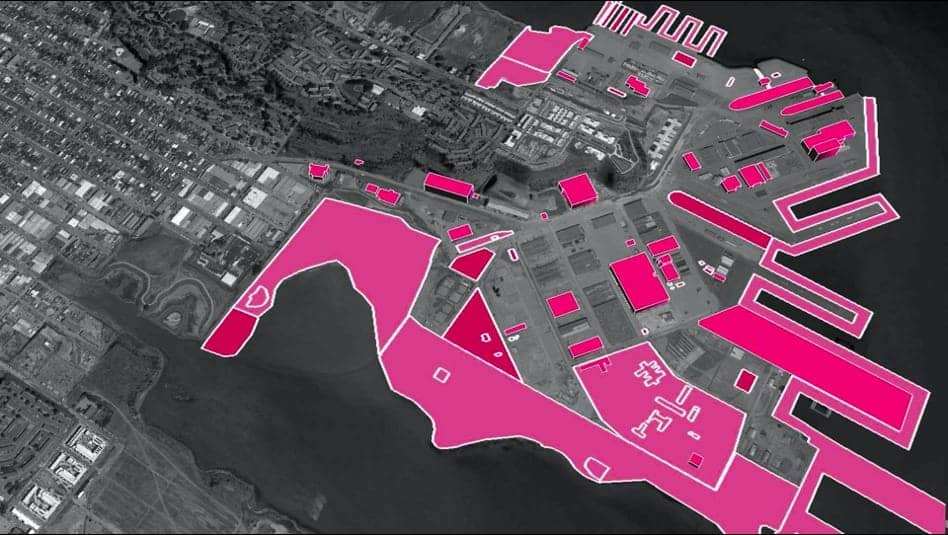
The 800 series NRDL lab complex includes Buildings 830, 830B, 831 and 815. The NRDL campus operated along the Crisp Road southern shoreline from 1946-1969. Building 815 was the main headquarters from 1955 to 1969. NRDL scientists poured radioactive waste into laboratory drains in Building 815 – with the approval of the Atomic Energy Commission. In 1955 the Navy began dumping radioactive waste into the Parcel E-2 Industrial landfill adjacent to residences, playgrounds, churches and community centers.
The Parcel E-2 Industrial Landfill is nested within the shipyard’s heavily contaminated southern shoreline. The shoreline drains south into the South Basin of San Francisco Bay and flows west toward 3rd Street via Yosemite Slough.
Hunters Point Community Biomonitoring Program and Public Benefit nonprofit foundation
The Hunters Point Biomonitoring Foundation was awarded a $250,000 grant from the Environmental Justice Data Fund to build a Community Window On Environmental Exposure – a project that will establish a toxic registry and virtual “window” on exposures to dangerous chemicals released during the dirty development of the Hunters Point Naval Shipyard.
Community Window on Environmental Exposures archives photo, video and eyewitness testimony of deep soil excavations and heavy equipment operations actively conducted by the Navy and Master Developer along the western fence line of the shipyard’s radiation contaminated shoreline. These data points are compared with the body burdens of fence line and shoreline workers using a urinary biomonitoring screening and cross referenced with the known toxicology of chemicals and radionuclides of concern and geospatial mappings of chemical, cancer and nutritional deficiency clusters.
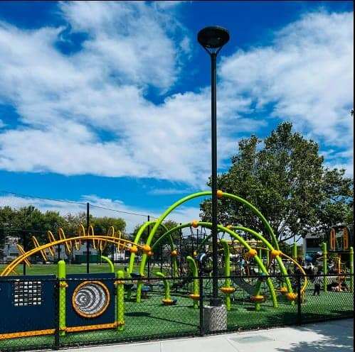
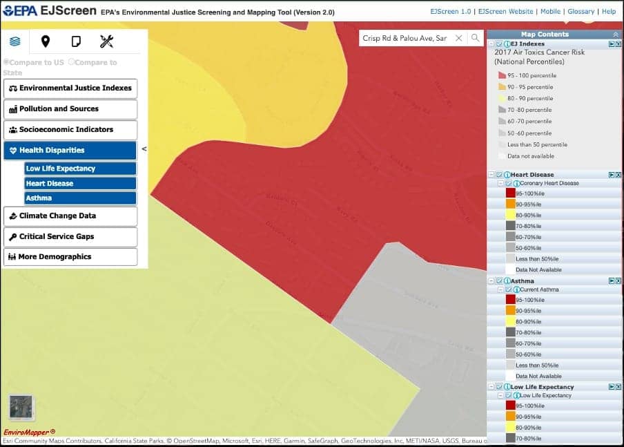
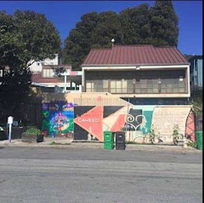
Private homes, public housing, playgrounds, churches, health care clinics, non-profit and historic mansions on Revere Avenue are located within feet of the most dangerously contaminated regions of the naval base. The Navy’s own Parcel E-2 Record of Decision (ROD) maps the close relationship between the Panhandle and Landfill Areas to UCSF shoreline workers fence line residents at the Panhandle Area from Palou Avenue to Yosemite Slough.
The Parcel E-2 ROD documents a toxic stew of contaminants buried within the shoreline and landfill and documents excess cancer risks as high as 6 in 10,000 in the Panhandle Area where Hunters Point residents live, work, play and pray and non cancer hazard indices as high as 100!
Geospatial mapping of radioactive biomarkers detected in fence line and shoreline residents clustered along the Palou Avenue corridor of entry to the radiation laboratory complex and western fence line extending north to the Hunters Point hilltop and south to Yosemite Slough.
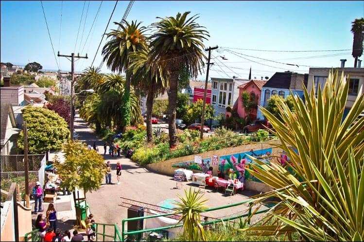
The HP Biomonitoring radiogenic cancer cluster documents cancers known to be induced by exposure to ionizing radiation include brain (yellow pins), breast (red pins), thyroid (green pins) and leukemia/lymphoma (white pins) centered along the western fence line and corridor of entry to the shipyards radiation contaminated shoreline and industrial landfill. A hotspot in the cancer cluster has emerged along Quesada Avenue where an award winning resident led community garden was born in 2002 to offer a green oasis and fresh produce grown along the median strip of Quesada Avenue. A ruler placed along Quesada Avenue lies on a direct trajectory east to the Parcel E-2 Industrial Landfill.
A 3-year-old boy who eats his vegetables!
A 3-year-old boy developed severe eczema when he was only 6 months old. He underwent urinary biomonitoring screening along with his mother and father in July of 2022. The family enjoys fresh produce grown in the Quesada Community Garden. Urinary screenings conducted on all three family members detect an alarming body burden of chemicals documented to be present at the Hunters Point shipyard including a profile of “signature” elements detected in Hunters Point fence line residents.
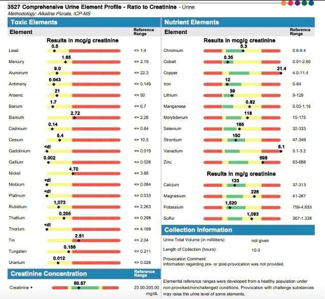
Nickel was detected in concentrations higher than allowable for the normal population. Nickel is a State of California Proposition 65 listed cancer causing chemical known to cause eczema. Nickel is a chemical of concern in shipyard soils frequently detected in biomonitoring screenings conducted on Hunters Point residents. Bismuth, tin, copper, vanadium and zinc are chemicals and radionuclides documented to be present at the Hunters Point Naval Shipyard.
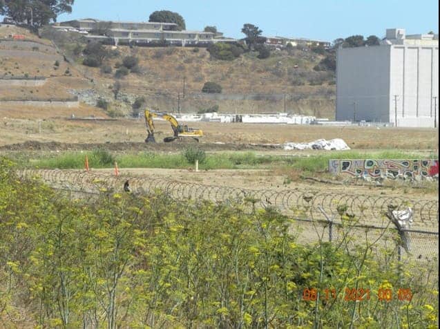
The photo was submitted to the Bay Area Air Quality Management District as a complaint and evidence of Proposition 65 violations. The Executive Order to advance the dirty development of the Hunters Point hilltop was issued by Mayor London Breed in the neighborhood with the second highest COVID-19 case rate and the worst air pollution.
Photo and video evidence submitted by a BAAQMD resident prompted the filing of a Proposition 65 legal injunction on June 19, 2021, on behalf of Hunters Point residents exposed to deep soil excavations at a fence line separating the dirty development of a Superfund site from the Willie Mays Boys & Girls Club, Wu Yee Children’s Services, Hunters View, Westbrook Apartments and Mariners Village.
In April of 2022 a 4-year-old boy died of brain cancer. He was born and lived on Navy Road – one block south of the photo submitted to BAAQMD in June of 2020.
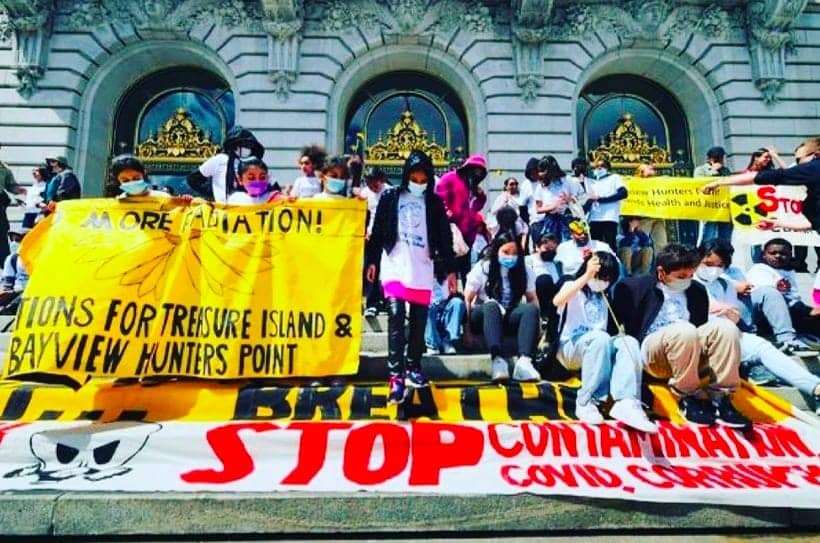
On Thursday, July 29, 2022 a National EPA Response Center Incident Report was filed by Hunters Point Biomonitoring Director and Principal Investigator.
In the week following activation of National Response Center Incident Report #1342958 dust barriers were erected along the entire Griffith Street western fence line north of the Crisp Road entry to the Hunters Point Naval Shipyard Federal Superfund Site. The Navy continues to exercise its Sovereign Immunity in endangering the nearby community.
SF Bay View Health and Environmental Science Editor Ahimsa Porter Sumchai, MD, PD, founder and principal investigator for the Hunters Point Community Biomonitoring Program, founding chair of the Hunters Point Naval Shipyard Restoration Advisory Board’s Radiological Subcommittee and contributor to the 2005 Draft Historical Radiological Assessment, can be reached at AhimsaPorterSumchaiMD@Comcast.net. Dr. Sumchai is medical director of Golden State MD Health & Wellness, a UCSF and Stanford trained author and researcher, and a member of the UCSF Medical Alumni Association Board of Directors.


